Wednesday 30 July 2014

Quilpie - 30 July 2014

We had a walk round the outskirts of the town this morning to have a look at the Bulloo River, which also runs through Thargomindah. There are signs along the river bank with items of interest. One of the signs pointed out that King Brown, Eastern Browns and Collared Whip Snakes are the venomous snakes found in the area. The Browns are not very nice ones at all.
It was a sluggish river today. Needs a good bit of rain to flush it through.

We walked passed the Powerhouse and it was open so we had a look through. Power came to Quilpie in 1952. Hard to believe Quilpie has only had power since then. That was the year I was born.

We ended up at the Bakery. Cathy, the lady who owns the Bakery, was the World Champion Ladies Shearer in 1998.

The Information Centre has a Museum attached to it and is very interesting to look through. The Quilpie area was devoted to both cattle and sheep farming in years gone by, but with the downturn in the wool industry, it is mainly cattle these days.

There was a photo in the Information of Scandalous Jack, a local character from Quilpie, who obviously let the odd swear word drop. I loved the description under the photo - "Scandalous Jack, who was given this nickname because of his skill in inserting the great Australian adjectives into every conceivable nook and cranny of normal conversation.''

There was also an exhibition on at the Information Centre of paintings by Melanie Hava. We had come across her paintings at Eulo, which is just south of Quilpie. We liked them and were pleased to see them again.

Next to the Information Centre is an excellent mural featuring highlights of the Quilpie area.


After lunch we went out to the Airport as there is a display there of Amy Johnson, the first female to fly solo from England to Australia. She completed the trip in 19 days in 1930. After landing in Darwin, she was making her way to Brisbane stopping at small airports in Queensland on the way. She was supposed to land at Charleville. On her map the rail line ended at Charleville, but it had been continued to Quilpie, so she landed here by mistake. She was very attractive.
 

We also drove out to Lake Houdraman, which is just a few kilometres out of town. There was quite a bit of water in the lake and we saw a couple of emus having a drink. There were quite a few people free camping there. You have to be fully self contained to stay by the Lake.

Late in the day we went to Baldy Top, which is a rocky outcrop about 3 kilometres out of town, to view the sunset. The red of the rocks just glowed from the sun's rays as it was going down. Just gorgeous.

Tuesday 29 July 2014

Quilpie - 29 July 2014

It was good to be able to catch up on the washing this morning. There is always someone to chat to and a trip to the laundry or the loo, can often take a lot longer than expected.

We walked up to town to see what there was. There are 2 supermarkets, a bakery, butcher, 2 pubs, 2 opal shops, chemist, post office, couple of coffee shops and a couple of mixed businesses. One of the mixed businesses had some patchwork fabrics and I had picked up a couple of fat quarters to add to my collection. I went to get my wallet from Bruce's backpack, only to find he had moved on down the street! Was it on purpose?! Tomorrow.

We saw a very unusual house in our wander round the town. It had a slippery slide next to the back steps. It was/is an old convent, but I can't imagine the nuns sliding down there.
The town has a lovely feel to it and seems a friendly place. The streets are really wide here, even the back streets. And everyone has their sprinkler on!
There is a lovely pub in the main street called Hotel Quilpie. The current people have owned it for 3-4 years and it has been done up beautifully.
We walked inside to see if we could have a look. The lady working there is a caravan traveller and is called back to Quilpie when needed. Last year they stayed at the Caravan Park, but this year they are staying in the Hotel. Her husband does the mail delivery for the Quilpie Mail Run, which we are doing on Thursday.

The hotel is just lovely inside. It has the pressed metal ceilings and is painted a soft green. It was built in the 1920's, so not as old as some of the pubs we have been to.
We were told to go upstairs and have a look, which we did. The rooms that we saw are fairly small and we wandered out on to the front verandah, which goes right across the building. There was a lady laying on one of the sun lounges, a guest in the hotel. I noticed she was reading the same book as I am at the moment - Written In My Own Heart's Blood by Diana Gabaldon. She loves the series as much as I do. But anyway we got chatting. Her and her husband caught the train out from Brisbane last week and go home on Friday, again by train. They love the place. I don't know how they get around as they don't have a car.

We had a look inside St Finbarr's Catholic Church. In 1976, Des Burton, the father of the boulder opal industry, built an opal wall for the church. That is now on the front of the altar, lectern and the baptismal font.
Tonight, anyone interested gathered to watch the International Space Station travel overhead. We also saw 3 satellites pass overhead as well. It was amazing to watch and clear as anything out here. The Space Station was launched on 20 November 1998 and has been added to over the years. The stats on it are mind blowing. It orbits 370 km above Earth; it travels at 7.71 km/second or 27,600 km/hour. It could travel to the moon and back in 1 day. It takes 92 minutes to orbit Earth. It is 109 metres long, weighing 419.5 kg.
 
After watching that, the guy showing us all this, who is the Manager, showed us a fantastic program on his laptop. It is a free download from www.stellarium.org and shows you the stars above you. It can also outline their shapes as well as giving you information about them. You don't need the internet to view it, only to download it on to you computer. It will be fantastic to check the position of the stars as we travel around the country.

Monday 28 July 2014

Dig Tree to Quilpie - 28 July 2014


Robyn and Neal followed us out the back way from the Dig Tree to the main road. They were saying the dingoes were at the Creek near their tent last night.
The gibber plains cover most of the area of Nappa Merrie that we drive through to get to the main road. The gibbers are so widespread out west. It would be partly why they need such huge properties to have a chance of surviving.

We saw about 6 B doubles this morning on our trip carrying demountables for a mine somewhere out this way. Obviously the mines out here are growing or they would be moving the demountables from one site to another.
We have hopefully finished travelling on dirt roads for this trip. So far this trip, we have done 900 km of dirt roads. Mind you, when we moved to bitumen, the road is only one car wide so you have to get off to pass any traffic. We passed a couple of wide loads this morning, which makes it interesting.

We actually saw a dingo feeding off a carcass. It was sharing the feed with some crows. The dingo just looked up at us and went back to what he was doing.
The trees have started getting a bit taller. We are seeing lots more road kill - roos, emus, wild pigs - than we have seen since before Noccundra. But this has a bonus. It brings out lots more wedge tail eagles, which we love seeing. And they aren't scared off as far when a car comes along.

We stopped at Eromanga for fuel at $1.65.9. Eromanga's claim to fame is that it is the furthest town from the sea in Australia. But they have also had some dinosaur bits and pieces found in the area. They are all sauropods (large herbivores). They have just had approval to build a dinosaur centre at Eromanga which will take about 18 months. We decided not to stop this time and come back then.

We ended up doing 460k today, a really big day. We checked into The Channel Country Caravan Park at Quilpie and I must say it was lovely to have a lovely shower and access to water on top, as well as mobile phone and internet access. We are back to the Artesian Basin. And there is actually grass and not red dirt, although that is still around.

When we arrived we found out that there was a camp oven dinner on tonight, so we thought it was a terrific idea. We had curried sausages which was very nice. The dinner was followed by a movie - Kings in Grass Castles. We are in the area where the Duracks first settled at Thylungra Station. I had read the book and I think I had seen the movie, but it was a long time ago.
Bruce checked his footy tips. As he hadn't been able to put his tips in, with no internet access, he got the away games. He ended up with 7 out of 8 games. He was rapt, and is in second place!

Dig Tree - 27 July 2014

Bruce heard dingoes last night, just before he went to sleep. They were just across the Creek.

After breakfast Bruce started making some fried scones (Puftaloons). Leigh and Diane were leaving this morning but called in for morning tea on their way out. They had never had fried scones before and were keen to try them. Duck came as well. They were a real hit and Diane took the recipe.

Leigh and Diane didn’t get away till after 11 and will probably stop at Innamincka tonight. We really enjoyed their company and hope to catch up with them at some stage.

Bruce was up at the gate this morning when a plane landed. There was an older couple and the pilot on board. Bruce was chatting to the lady and she said they had flown in from Broken Hill. Her husband didn’t want to drive up to the Dig Tree but really wanted to see it so they flew. Her husband came out of the loo and got a shock to see Bruce as there was no car and they thought they were by themselves. It was quite funny. Altogether 4 planes came in today and apparently that is quite normal.

After lunch I headed over to the Dig Tree to have another look. There are 2 trees with carvings on. There is a plaque which has engraved what was on each of the trees. Some of the carving  on the trees is no longer visible.
 
 
While I was at the Dig Tree I got talking to a couple who were there. Robyn and Neal are from Cairns and they are following along part of Burke’s footsteps. Neal had quite a knowledge of Burke and Wills and they are heading up to Burketown, eventually. They ended up coming over to join us for afternoon tea.

Robyn and Neal used to live at Traveston in the Mary River Valley and their property was resumed when the Dam was planned. They were devastated and felt they couldn’t stay in the area and moved to Cairns. They invited us to stay with them when we are up that way. They are wildlife carers and were lovely people.

We went for a walk late in the afternoon and ran into Duck doing his rounds. We chatted to him for a while, thanking him for looking after us. He is a lovely man, and a bit of a character, and has many stories to tell.  We did ask him why we hadn’t seen any roos around, and apparently the dingoes keep their numbers right down.

Our walk took us up the Creek a bit where there is no water and it is just very rocky.


We forgot to get any meat out of the freezer this morning and of course no power, so no microwave. The tin of soup was very nice!

Dig Tree to Innimincka - 26 July 2014

When we spoke to Duck last night, he told us about a back road from the Dig Tree to the main road that is not as bad as the one we came in on. It is like a highway compared to that one and it is also shorter. We took that this morning to make our way to Innamincka for the day, leaving the van behind at the Dig Tree. But not before taking a few photos of the Cooper Creek with its reflections and having brekkie by the camp fire.

It is about 50 kms to Innamincka from the Dig Tree. The main road is sealed to the South Australian border, and once you get to the border, the road is dirt and really deteriorates and it stays like that to Innamincka.

The town of Innamincka is a dusty little place as the roads round the small town are all dirt. It is an interesting place though. It is the beginning of lots of tracks, e.g. the Strezlecki Track and Walkers Crossing, which takes you to the Birdsville Track. There is a pub there, The Innamincka Hotel, as well as a Trading Post and the National Parks office. In the back streets there is a crane company, a transport company, an accommodation place and a few other places. The Trading Post sells fuel as well. Across from the Trading Post is a Public Ablutions block with showers and toilets as well as a laundry with a couple of tubs in it, no washing machine of course, as water is in short supply. On the way in to town, we passed a tanker leaving. It had left a load of drinking water for the town.

 
The building where the National Parks is located used to be a nursing home but closed in 1951 and fell in to ruin as the materials were used elsewhere. The service provided by the nursing home was taken over by the Flying Doctors. It was also in the midst of a big drought, and visitors to the area were dropping. In the early 1990’s it was rebuilt from the ruins and made into the National Parks office. Innamincka is on Cooper Creek as well and when we drove down to have a look at the Town Common on the Creek, there were lots of people camped along there.

 We drove passed a shed in one of the side streets of town with a Danger sign on it. It advised that it was a Military Target area, and not to touch anything as it may explode and kill you! Don’t know whether it is for real or not. Also next to the accommodation place not far away was another loo size shed with an Explosives sign on it. Anything goes in Innamincka I think.

We noticed a flood level marker between the Creek and the town. The height was 14 metres. It is just so hard to imagine that.

We had come prepared to Innamincka and went and had a lovely hot shower in the Ablutions Block. It was $2 for a 3 minute shower. I’m afraid I used $4 but turned the water off before the end. My hair was covered in shampoo when the water stopped after the first $2! We both felt wonderful. It’s the small things that make you happy. They were being well used by visitors. The flies are not as bad at Innamincka.

We had lunch at the Pub and had a Yellowbelly Burger and it was beautiful. There was a Canadian backpacker working behind the bar. She has been here for a month and will be there over the summer. She is from Toronto. She enjoys it so far but I think the summer will be a shock for her. The Pub has built on a dining room to the Pub and they call it the Outtamincka Bar. Got a sense of humour. Pretty snazzy.

We were hoping to have phone reception in town but no such luck, and even the paper was a bit behind. Bruce read Wednesday’s Australian while having lunch! We filled up with diesel at $2.09.7, the most we have paid this trip.

We headed back to the camp site and Duck joined us for a drink. He used to work for Sidney Kidman on Durham Downs, which is north of Nappa Merrie. Durham Downs was the jewel in the crown of the Kidman empire. He worked for him for 8 ½ years as a cattle drover and he has a mug he uses that was given to him by Kidman with the Kidman crest on it and Duck’s name.

Leigh and Diane joined us as well for Happy Hour, before everyone parted for dinner. Leigh and Diane came back later for the campfire and we had another good night.

We have decided to spend another day at the Dig Tree. It is such a beautiful place, so peaceful. To imagine you are walking in the footsteps of Burke and Wills is amazing.

Noccundra to Dig Tree, Cooper Creek - 24 July 2014

We filled up with fuel at $1.89 litre at the Pub before heading north. It is getting warmer. In fact, last night was lovely and warm, and the days have been beautiful. The thermometer said 15 degrees in the van last night, and that was without the heater. We didn’t need it.

The fellow who owns the Pub has had it for 2 years and before that he spent 6 ½ years on the Jackson Oil Field, which we went passed today. We passed Naccowlah Gas Field and Ballera Gas Centre as well.

We were on sealed road most of the day today, with many road trains passing us. There was a section of dirt though. We could see cloud and a bit of rain to the south of us. As it turns out I don’t think the rain would have been a problem at Tibooburra. Never mind.

There were some beautiful mesas that we passed. Again, just springing up from nowhere, and the colours are just beautiful.

We started going over floodways that took us over dry creek beds. There had been signs with the name of the creek on it, but all the signs have been taken except on. The only sign left tells you that you have gone over 14 kms of the Cooper Creek Floodplain.

 The Dig Tree is situated on Nappa Merrie Station and they manage the Dig Tree area. You turn off the main road, and travel for 14 kms on a pretty bad dirt road, full of bull dust, corrugates and rocks, with some good patches as well. We took it very slowly and got to the Dig Tree okay. At the entrance to the Dig Tree area, there is a shelter. Inside the shelter is a picture board of the history of the Dig Tree, with information about the property and its history as well. Nappa Merrie itself is owned by Santos, but the property is leased by the Kidman’s. Apparently the Kidman’s are relinquishing the lease at the end of the year. It is 2,500 square kilometres in area. It is around 3 million acres. Hard to comprehend the actual size of it.

The fee to enter/stay at the Dig Tree is $11. We thought this was per night so put $22 in an envelope for 2 nights, but found out later that we could have stayed for a week for the $11.

We picked a spot very close to the Tree itself, and right on Cooper Creek. The Creek is reasonably wide where we are, but the water is only a few feet deep. It also doesn’t extend all that far either way at this point, before it is dry. We spoke to the Ranger, Duck (the name he has gone by all his life – he is 76 – his name is Donald) who told us that if it doesn’t flood in Queensland by September/October this year and the water travel down, it will be dry.

One thing that struck us was the bush flies. They are really bad and just stick to you. On went our nets! Certainly won’t win any fashion awards but they work.

 
We then went up and read the information on the Dig Tree in the shelter before heading across to the Dig Tree itself. It is an amazing story about Burke and Wills. Burke had no experience at all at this sort of thing and got the job because he knew someone of influence and all the fanfare about his departure from Melbourne. To actually find a way from south to north and to die before he and Wills could get back and report it is sad, but it is a story that captures your imagination. To think Burke and Wills got back only 9 hours after the rest of the party had left. There is some confusion as to which is the Dig Tree itself. One of the trees has LXV on it (stands for Camp 65). They have had to cover the other side of the tree to help preserve it. On another tree is the face of Burke carved by a fellow in 1898 and ROB (Robert O’Hara Burke’s initials) underneath. Also on that tree is the word DIG with something underneath. There is some conjecture this was carved by Brahe, who was in charge of the party who stayed behind. We will never know.


Back at the van, Duck (the Ranger) came over to chat and said to Bruce to hop in his (Duck’s) ute and he would take him to get some logs for the campfire. He came back with 2 huge logs.

After dinner that night, a couple that are camped a couple of hundred metres up the Creek from us, came down to join us at the campfire. Leigh and Diane arrived at the Dig Tree yesterday. They are heading to Perth via Birdsville and Darwin for their son’s 40th birthday in December. They lived in their van for 5 years until about 18 months ago, and they now live in Victoria. We had a great night and we didn’t get to bed till about 11.30.

The stars in the night sky here are just magical. The Southern Cross is so clear, as are all the stars.

There are 4 lots of people camped by the Creek tonight. Diane and Leigh said they were the only ones last night. There are quite a few people who just call in to have a look at the Dig Tree, either on their way to Innamincka or back from there, without actually staying here.

Tibooburra to Noccundra - 23 July 2014

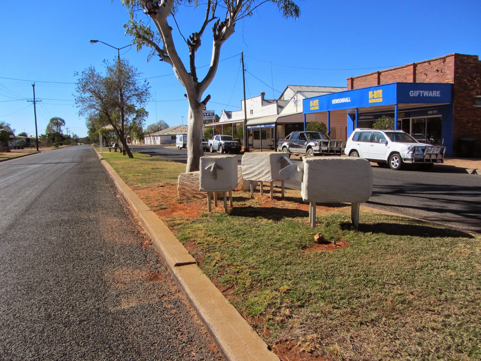
We had a little rain last night. Apparently if it rains in Tibooburra, there is a chance you will find gold in the main street as has happened to a couple of people!

Before heading on to Noccundra this morning, I went to check out the replica of the boat used by Charles Sturt on his expedition to look for the inland sea. In 1844-45 he hauled a 27 foot whaleboat as far as Lake Pinaroo, not far from Cameron’s Corner. We passed Lake Pinaroo yesterday on our trip. The boat was abandoned on his return trip not far from the Lake.

On walking back through town I chatted to a lady who was walking her kids to school. I asked her about the school being School of the Air. She said there was actually a meeting about it last night, and it is looking like it will cease to be School of the Air. There are 11 kids attending the school at the moment, the furthest travelling 30kms. She said it had its pros and cons, the main one being support for those further away. She said a friend of her daughters who lives 50kms away will now be doing her schooling through Broken Hill School of the Air and as a result, will miss out on the interaction with the other kids.

It would have been good to have another day in Tibooburra, but rain is forecast for tomorrow. We don’t want to get stuck in town and miss out on other parts of our trip. But we have enjoyed what we have seen of the area. To see Cameron’s Corner and the Dingo Fence was great. I didn’t expect to get there, but it was a matter of just talking to people about the roads and the conditions.

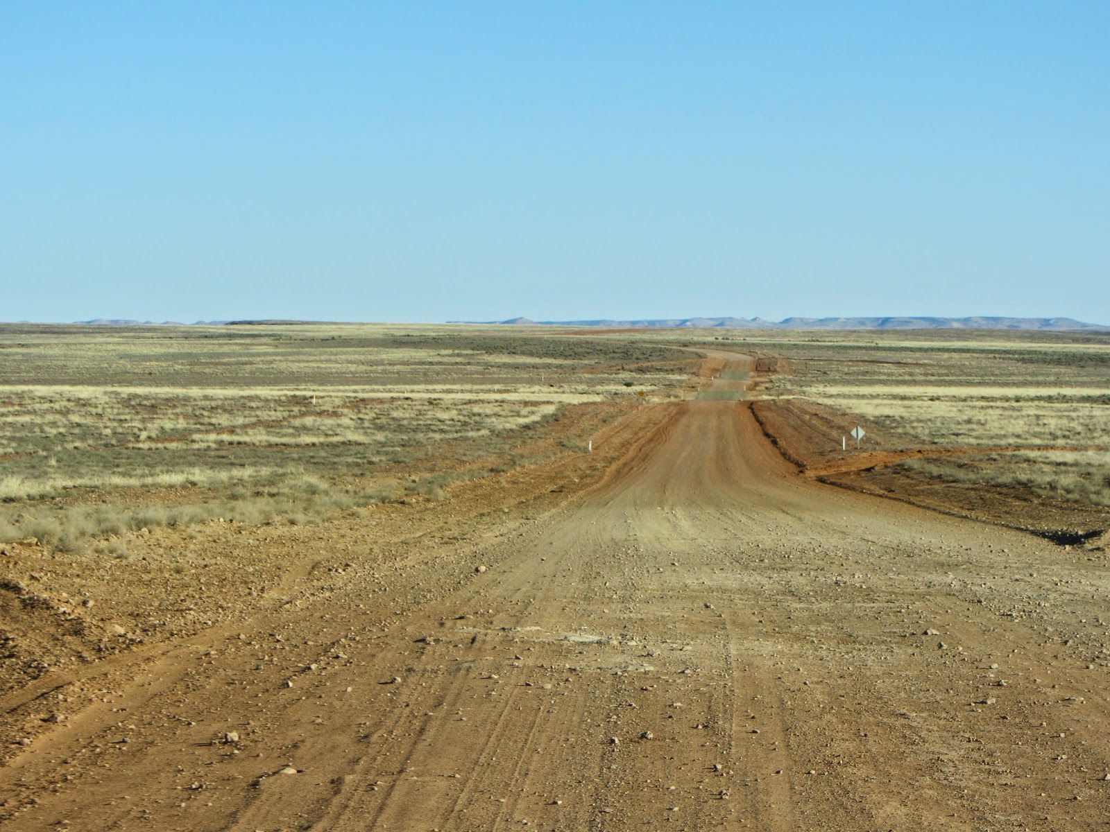
 The countryside is quite scenic and, as always, ever changing. It just seems to go on forever. We passed some more hills/mountains, or mesas, with their flat tops. You can understand why they call them jump ups as they just spring up out of nowhere.

Up towards Warri Gate is part of the Coopers Creek Catchment area for Lake Eyre. It certainly stretches a long way.

It was a 55km trip north as far as Warri Gate on the Queensland border. We had to stop and open the Gate to enable us to drive through, closing it behind us. This let us through the Dingo Fence, something else I have learnt on this trip. I knew there was a Dingo Fence but it hadn’t occurred to me that there would need to be gates. A bit silly of me, as the Fence would be useless without them!

The road was not too bad, although our speed was fairly slow. We drove anywhere from 20kph to 60kph, but mainly somewhere in between. There were lots of patches of bull dust. I actually got out to feel it and was surprised, as to look at, it looked just like it was dried mud where someone had driven through. It was very soft and I can understand how people get caught in it.


We saw a father emu with 6 chicks and managed to get a good photo.

Bullo Downs is the first station after you get through Warri Gate. A fellow called Reid married one of Sidney Kidman’s daughters and they owned this property.

All along this road are oil and gas drilling sites and pipelines – Santos, AGL, Orientos, etc. While we were stopped for lunch a B Double gas tanker went past, throwing up a cloud of dust.


We arrived at the Noccundra Pub (built in 1882) about 3.30, having travelled 225 kms. It took about 6.5 hours, so a very slow trip. We will stay here tonight and head out to Burke and Wills Dig Tree tomorrow. Noccundra has a population of 4. The only thing here is the Pub and the Wilson River.

There is an English girl from Manchester working in the Pub. We chatted to her when we arrived. She has been here in Australia for 10 months, heading home in September. She worked in Cunnamulla before coming here. As she has done at least 3 months in a remote area, she gets a further 12 months visa. She can do that extra 12 months at any time and would like to get sponsorship to come back. She had only just finished university before coming out, so she said she will go home and work for a bit to get some experience before coming back.

We went for a walk over to the Wilson River, which is about ¾ km from the Pub, which is where you can free camp. Bruce wasn’t sure if our fridge was working on gas properly so we paid for a powered site behind the Pub. As it turns out, it is working okay. The Wilson River has quite a bit of water in it and it is a lovely spot to be camped. It is also carp free and it is illegal to use carp for bait. We talked to a couple of people camped there, one in a van and another in a bus. 

Parked next to us behind the Pub were 2 vans. When we got back from the walk to the river, the 2 couples arrived. It turned out they are the people who were parked next to us at White Cliffs. Small world. They had been out to Innamincka for the day – about 440 kms return trip.

There is no mobile phone or internet reception here.

There are showers to use behind the Pub. Unfortunately, it is river water , and a dirty colour as it has all dust and dirt through it, but at least we had a wash. My hair doesn’t feel really clean though, but who am I to complain. Look where I am and what I am doing. I am so lucky to be able to be here.

Wednesday 23 July 2014

Tibooburra to Camerons Corner - 23 July 2014

Our reason for coming to Tibooburra was to go out to Cameron's Corner, where the 3 States meet - South Australia, Queensland and New South Wales. We called in to the National Parks Office as you need to travel through the Sturt National Park to get there and there is a $7 fee. They give you an information sheet for the road we would be travelling on, explaining everything you would be seeing. It was great. You can go out on the main road, or else on a 4WD track through the Park. We drove out on the 4WD track and back on the main road, although the term main road was a misnomer in this case! The 4WD track was better. It was 170km on the 4WD track and 140km back on the main road. We left the van at the caravan park here in Tibooburra thank heavens. The speed limit for the road through the National Park is 40 kph.

It was a great drive through the National Park. We had been told by someone we had met on this trip, that it was worth doing.

Mt King Station was the first Station bought up to be part of the National Park around 1972. There is not much left of it now as it was dismantled at the time and the timber, etc. used elsewhere. There are a few Stations that became the Sturt National Park. Olive Downs was another and it is now a camping ground. The dams (or tanks as they are called here) still had water in them. They are very deep.
There must have been a shower of rain earlier this morning as the road was a little bit wet in patches. Luckily it wasn't too bad or we wouldn't have been able to come.
Something that surprised me is that there are mountains/hills out here. I expected it to be dead flat and nothing growing. I was wrong on both counts. One of the ranges is called the Grey Mountains and they are called jump ups as they just spring up in front of you. We drove up to the Lookout on top and had morning tea. In no time we were joined by 2 other cars. After they left we didn't see another car till we got to the Corner. The view from the Lookout was very impressive.
We passed through gibber plains, which I remember learning about at school. We passed Lignum Swamp, which only floods during rain and then we came to sand dunes, before coming to Lake Pinaroo, which has no water in it but is a vibrant green. Once it is filled with water, it can take up to 7 years to become dry.
We saw heaps of Big Red Kangaroos and managed to get a great picture for Don, our neighbour.

We arrived at the Dingo Fence (or Wild Dog Fence as it is now called). It was originally built in 1887 as a rabbit fence to keep rabbits out of South Australia, but that didn't work so they built it higher in 1914 to keep the dingoes out of sheep grazing area. It is the longest fence in the world at 5,614 km (longer than the Great Wall of China) and extends from Jimbour in Queensland to the coast of South Australia.

We had to open a gate to get through the Dingo Fence and on to Cameron's Corner, which is just over the hill you can see in the photo.
Cameron's Corner is marked with a white cement post with a plaque on it and on the top of the post a plaque indicating where the different States are that meet at that point. You can see the fence in the background in the photo below as well as the post.
At Cameron's Corner is a general store, which sells fuel for $2.00/litre for diesel. There is also accommodation - units, powered sites and camping sites. The general store sells meals and they were quite reasonable considering where you are. We had a steak sandwich and had a good look around. There are caps nailed to the walls inside and they have started nailing money to the ceiling as they have run out of room for caps. There are also a couple of fairways so you can play golf in 3 States, but no one was playing today.
We headed back to Tibooburra, as I mentioned earlier, along the main road. Along this road there is a marker indicating that this area flooded in the 1974 flood. A fair bit of this drive was very flat, but offered a good contrast to what we had seen on the way out. We did pass Black Stump Creek so we have now been out beyond the black stump!

Silverton to Tibooburra - 22 July 2014

We had to go back to Broken Hill to head out to Tibooburra, which is due north about 330 kms. We stopped in Broken Hill to go to Howard William Steer’s Gallery. We had seen some of his paintings in Silverton and really liked them. He was opening up early for us as I had rung him yesterday. We talked to him for quite some time; a lovely man. A lot of his paintings have a Royal Flying Doctor theme and he raised lots of money for them. He has lived in Broken Hill all his life and his father was Mayor from about 1912-1916. He has been painting for 41 years and was a Vietnam Vet. He has raised $360,000 for the Royal Flying Doctors. He showed us a painting he is doing for the AFL Footy Show. He did one last year and it raised $10,000. We even gave him an idea for a painting. We did ask for commission! We bought one of his paintings – not an original though.

We didn't get away from Broken Hill then, till about 10.15. As we were leaving, we heard on the news that the thief had struck in a caravan park in Broken Hill again. Thank heavens we got away unscathed.

The road to Tibooburra is a combination of dirt (about 100 kms) and sealed. The fellow who looks after the roads out there used to work in Sydney in the same capacity. Each time a culvert or floodway/causeway needs repair, he requests the same amount of money he used to in Sydney. And of course the roads out here are not as wide as on the east coast. As a result, a little bit more of the road gets sealed! Very good way of getting things done.

Seeing we were getting more remote, it was greener than I expected. We drove past a group of about 6 sheeps and a cow that were dead on the side of the road. Hard to work out how that happened - maybe a truck?

About half way or so along the road is a place called Packsaddle. You can actually turn off there and head into a property of the same name, but on the roadside is a Roadhouse with a café and petrol bowsers, as well as accommodation. Petrol was $1.84, which wasn't too bad. We stopped here for lunch in our van.
We passed Fowler's Gap, which is a University of New South Wales Arid Zone Research Station. They couldn't have picked a better place for it! It was quite a big complex.
 
There were graded culverts/dams on the side of the road as we drove along. We had seen similar out near Eulo and Thargomindah and assume they are for water collection when it rains.
 
We were lucky enough to spot a few wedge tail eagles feeding on some road kill. Of course, they flew off when we approached but settled in a tree back a bit further. I managed to get a reasonable photo and will be able to crop it when I get home.

There was also quite a bit lake along the way, called Salt Lake. Across from that were clay pans. Such a variety of scenery.
Along the roadside was the grave of Eliza Kennedy, who died in 1886 aged 32 years. So many people died around that time due to typhoid. It didn't say on the headstone. It was restored in 1997.
 
We checked into The Granites Caravan Park in Tibooburra. Again there is no water to connect to, and in fact the town is just about out of water. Rain is forecast for Friday. Hopefully it is good to them.

We went for a walk around town to stretch out legs. There is an outdoor theatre, a bit like a drive in but no speakers. Not sure how often it is used. The school here is actually a School of the Air.
There are 2 hotels in town, both dating from the 1880's.

It was a pretty good road from Broken Hill to Tibooburra, but we drove about 60-70 kph through the dirt strips. So, it was a long day. We left at about 10.15 and didn't get here till 5. It does stay lighter longer here, which is good.